- Cart - 0 items
Cart is Empty.
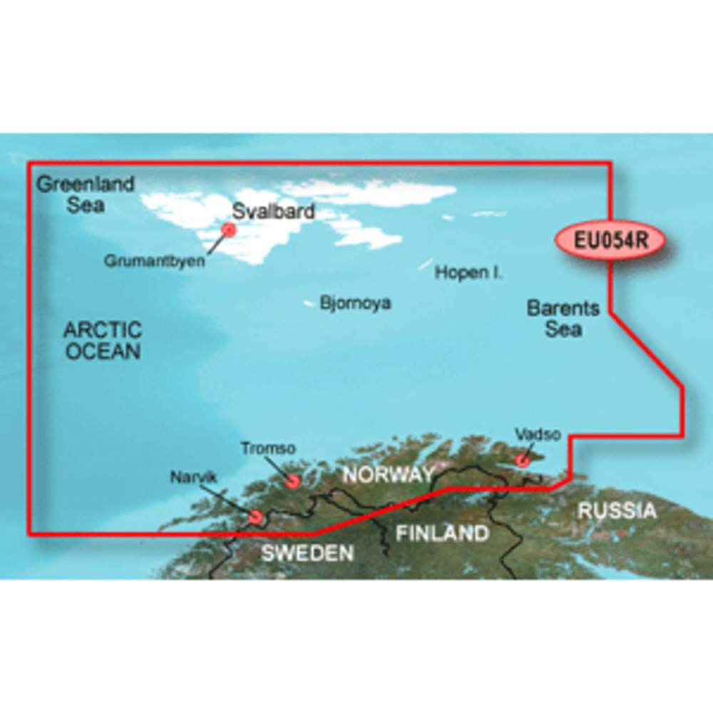
BlueChart® g3 HD - HXEU054R - Vestfjd - Svalbard - Varanger - microSD™/SD™
Coverage:
Detailed coverage of the northern Norway coast from Vestfjorden to Vadso including Tromso and Narvik. Also includes coverage for Svalbard and approaches.
Unparalleled Coastal Chart Coverage
$115.74
BlueChart® g3 HD - HXEU054R - Vestfjd - Svalbard - Varanger - microSD™/SD™
Coverage:
Detailed coverage of the northern Norway coast from Vestfjorden to Vadso including Tromso and Narvik. Also includes coverage for Svalbard and approaches.
Unparalleled Coastal Chart Coverage
BlueChart® g3 HD - HXEU054R - Vestfjd - Svalbard - Varanger - microSD™/SD™
Coverage:
Detailed coverage of the northern Norway coast from Vestfjorden to Vadso including Tromso and Narvik. Also includes coverage for Svalbard and approaches.
Unparalleled Coastal Chart Coverage
Related Products
Copyright © TechBuys All Rights Reserved.