- Cart - 0 items
Cart is Empty.
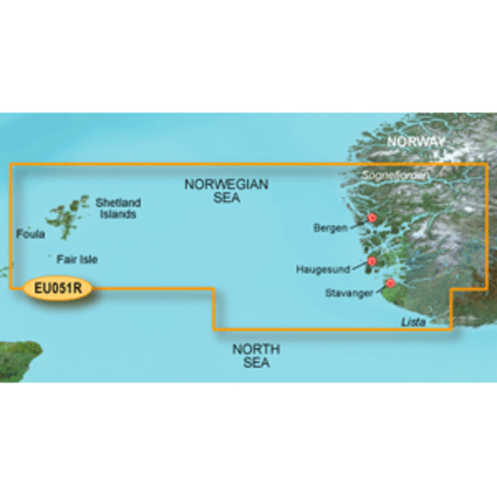
BlueChart® g3 HD - HXEU051R - Lista - Sognefjorden - microSD™/SD™
Coverage:
Detailed coverage of the Norway coast from Farsund to Sognefjorden, including the Shetland Islands. Includes detailed coverage of Bergen, Haugesund and Stavanger.
Unparalleled Coastal Chart Coverage
$115.74
BlueChart® g3 HD - HXEU051R - Lista - Sognefjorden - microSD™/SD™
Coverage:
Detailed coverage of the Norway coast from Farsund to Sognefjorden, including the Shetland Islands. Includes detailed coverage of Bergen, Haugesund and Stavanger.
Unparalleled Coastal Chart Coverage
BlueChart® g3 HD - HXEU051R - Lista - Sognefjorden - microSD™/SD™
Coverage:
Detailed coverage of the Norway coast from Farsund to Sognefjorden, including the Shetland Islands. Includes detailed coverage of Bergen, Haugesund and Stavanger.
Unparalleled Coastal Chart Coverage
Related Products
Copyright © TechBuys All Rights Reserved.