- Cart - 0 items
Cart is Empty.
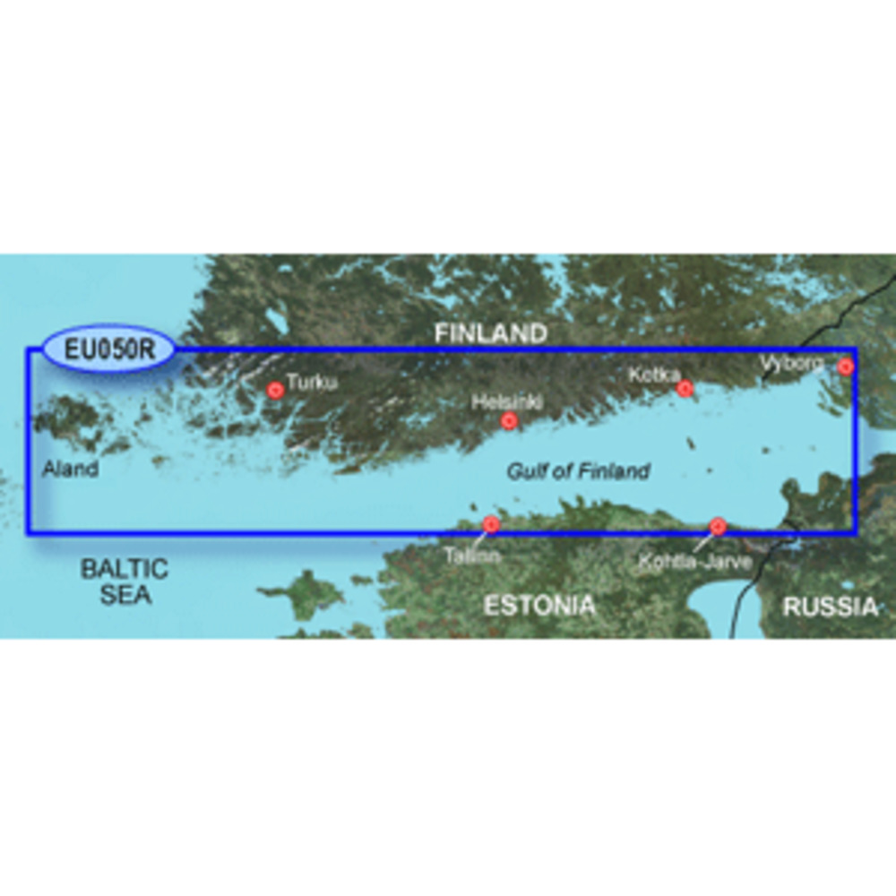
BlueChart® g3 HD - HXEU050R - Aland to Vybord - microSD™/SD™
Coverage:
Detailed coverage of the Gulf of Finland from ludes detailed coverage of the cities of Turku, Helsinki, and Kotka in Finland and Tallinn and Kohtla-Jarve in Estonia.
Unparalleled Coastal Chart Coverage
$115.74
BlueChart® g3 HD - HXEU050R - Aland to Vybord - microSD™/SD™
Coverage:
Detailed coverage of the Gulf of Finland from ludes detailed coverage of the cities of Turku, Helsinki, and Kotka in Finland and Tallinn and Kohtla-Jarve in Estonia.
Unparalleled Coastal Chart Coverage
BlueChart® g3 HD - HXEU050R - Aland to Vybord - microSD™/SD™
Coverage:
Detailed coverage of the Gulf of Finland from ludes detailed coverage of the cities of Turku, Helsinki, and Kotka in Finland and Tallinn and Kohtla-Jarve in Estonia.
Unparalleled Coastal Chart Coverage
Related Products
Copyright © TechBuys All Rights Reserved.