- Cart - 0 items
Cart is Empty.
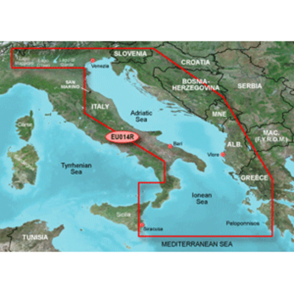
BlueChart® g3 HD - HXEU014R - Italy Adriatic Sea - microSD™/SD™
Coverage:
Includes all of the Adriatic Sea and extends south to Siracusa, Sicilia and Gulf of Arcadia, Greece. Includes detailed coverage of Lago Maggiore, Lago d'Iseo, and Lago d'Garda in Italy.
Unparalleled Coastal Chart Coverage
$115.74
BlueChart® g3 HD - HXEU014R - Italy Adriatic Sea - microSD™/SD™
Coverage:
Includes all of the Adriatic Sea and extends south to Siracusa, Sicilia and Gulf of Arcadia, Greece. Includes detailed coverage of Lago Maggiore, Lago d'Iseo, and Lago d'Garda in Italy.
Unparalleled Coastal Chart Coverage
BlueChart® g3 HD - HXEU014R - Italy Adriatic Sea - microSD™/SD™
Coverage:
Includes all of the Adriatic Sea and extends south to Siracusa, Sicilia and Gulf of Arcadia, Greece. Includes detailed coverage of Lago Maggiore, Lago d'Iseo, and Lago d'Garda in Italy.
Unparalleled Coastal Chart Coverage
Related Products
Copyright © TechBuys All Rights Reserved.